High resolution multispectral aerial mapping of the Rio Chama
3D terrain modeling of a complex, remote environment
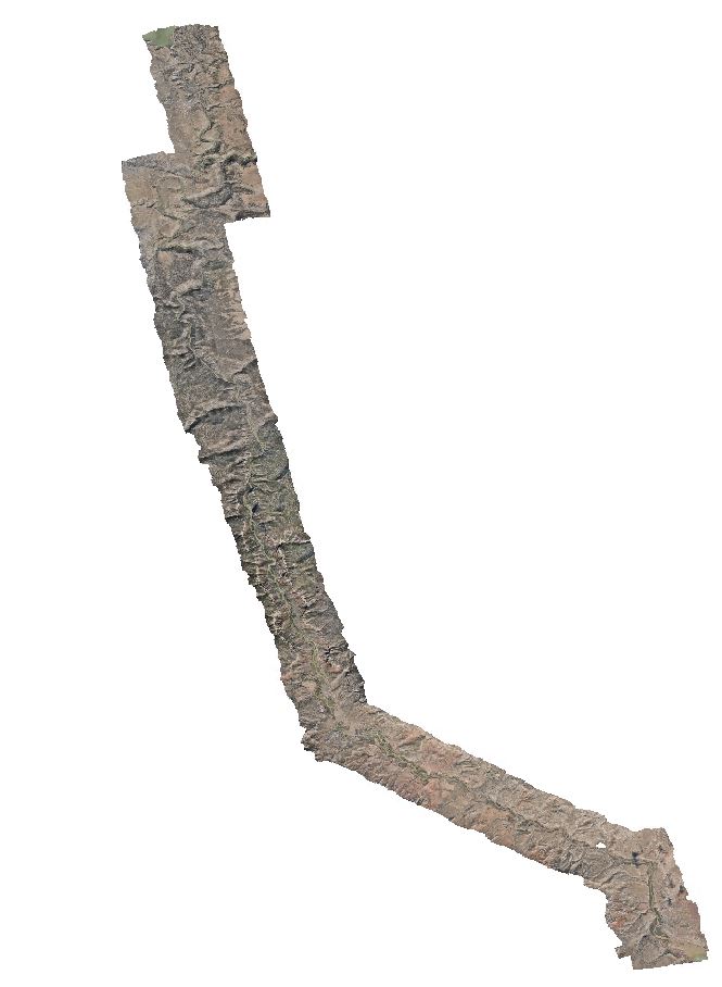
In 2018, we collaborated with the US Army Corps of Engineers to collect high-resolution multispectral aerial imagery of the 82km Wild and Scenic portion of the Rio Chama in northern New Mexico. USACE required a high-fidelity digital terrain model to serve as a baseline for future assessment of post-restoration changes to channel morphology following planned alterations to flow release protocols from El Vado Dam. Over the course of six field sessions, we collected over 15,000 frames of RGB and NGB imagery at 10cm ground sampling distance (GSD). Images were collected using a simultaneously triggering dual Nikon D810 DSLR camera system affixed to aircraft piloted by the Civil Air Patrol. Data collection was managed in-flight using the Aviatrix flight management system. Ground control points were collected over the course of four field sessions via real-time kinematic (RTK) surveying using a Trimble R10 GNSS system. The images were post-processed and registered in Agisoft Metashape Professional to produce a digital surface model (DSM) and orthomosaic with horizontal error +/- 30cm and veritical error +/- 66cm. I served as the primary technician collecting imagery and ground control data as well as producing the image products. These products are available to the public upon request to the ASPIRE lab manager.