Railrock UAS Mapping
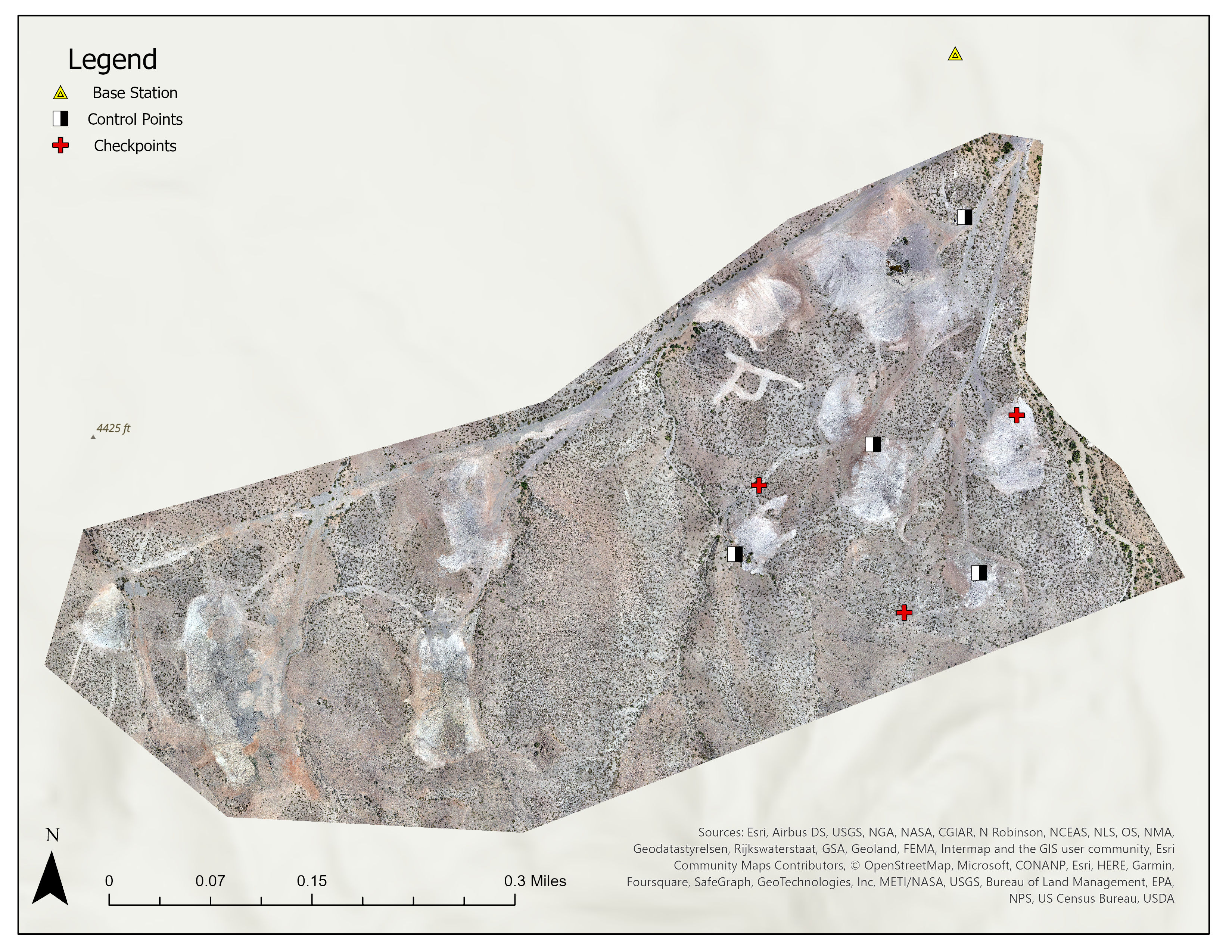
In May 2023 I collected 1.6cm resolution RGB imagery of a State Land Office parcel in southwestern New Mexico to support the agency's planned inventory and restoration efforts. The flight was conducted using a Wingtra One Gen II drone equipped with a Sony RX1R II sensor. Additionally, I conducted an RTK GNSS survey of ground reference points at the site for geometric registration of the imagery. The imagery was post-processed in Agisoft Metashape Professional to produce an orthomosaic and digital surface model with spatial resolutions of 1.6cm and 3 cm respectively, with horizontal error +/- 1cm and vertical error +/- 20cm.