Valle de Oro National Wildlife Refuge LiDAR
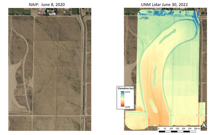
In June 2022, working with UNM Earth and Planetary Sciences, the Bureau of Reclamation, and Valle de Oro National Wildlife Refuge, we collected a sample LiDAR dataset of a recent wetland restoration area on the Refuge. We used a Zenmuse L1 sensor for LiDAR collection (with simultaneous RGB imaging for point cloud colorization), with a point cloud density of 98pts/m2. I was the drone pilot for this mission, coordinating appropriate access permissions, and post-processed the LiDAR data into a point cloud for reference by land managers. Map by Gary Weissman.